
Manhattan has changed substantially over the past 400 years by not only the people who have lived there, but also by the many people who commute to the island to work on a daily basis. Although the city of New York is now a super metropolis with greater than 8.5 million inhabitants, significantly more people call the boroughs of Brooklyn and Queens home than Manhattan…
Watch Manhattan Grow Over a Period of 400 Years — Plus a Bonus Treat
…but take a look at the earliest known map of New Amsterdam — as it was then called — and you will see a very different island.
This article from Angie’s List uses information which is found in the archives of the New York Public Library and the Library of Congress to create the animation and series of maps of Manhattan over the centuries which allow you to watch Manhattan grow over the past 400 years. It shows how the foundations were laid for what Manhattan is today.
I have been given express written permission to use the images and the verbatim text from the aforementioned article in this article; so let us take a break from the news of the day and have a little fun.
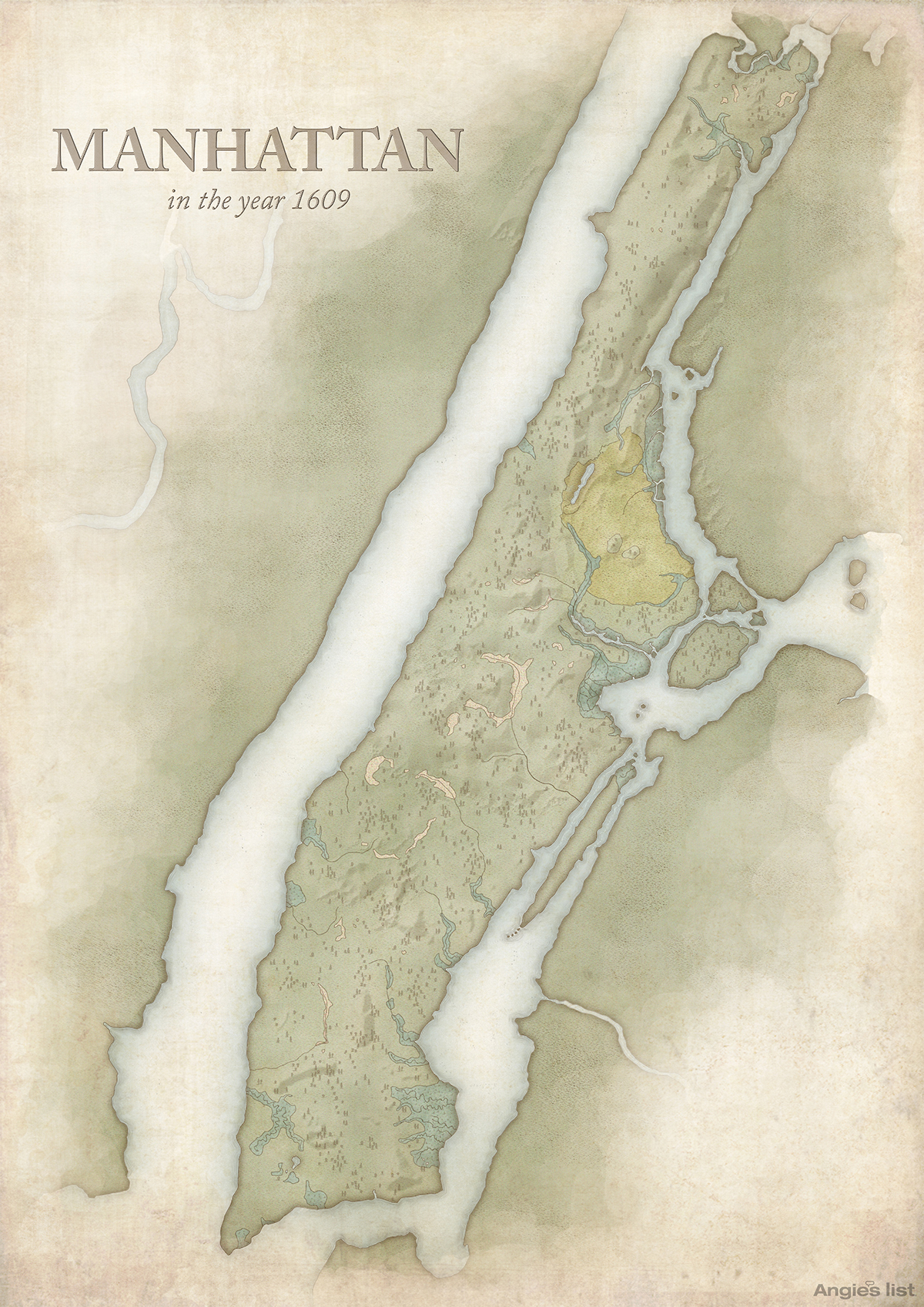
1. Manhattan in the year 1609
During this time, Manhattan, or “Mannahatta,” as it was known, was home to the Lenape and other Native American groups. The Lenape named their island home “Mannahatta,” which means “Island of Many Hills.” The map shows the wild hills, valleys, forests and fields that were home to bears, wolves and all manner of birds. The beaches, springs, ponds and streams provided shelter for salamanders, porpoises and whales.
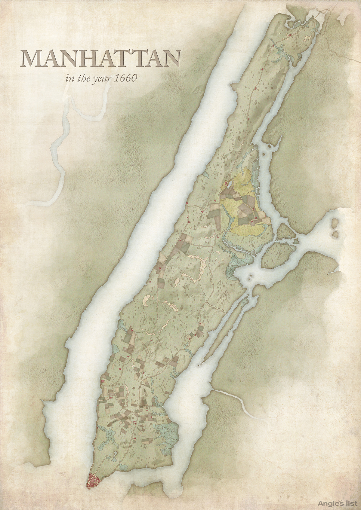
2. Manhattan in the year 1660
This map was based on the earliest known map of New Amsterdam, which dates back to 1660. During this time, the island was a “thinly populated, uncomfortable and muddy place.” In fact everything north of the Canal was either wild or farmland. When the English took over in 1664 they renamed the city New York.
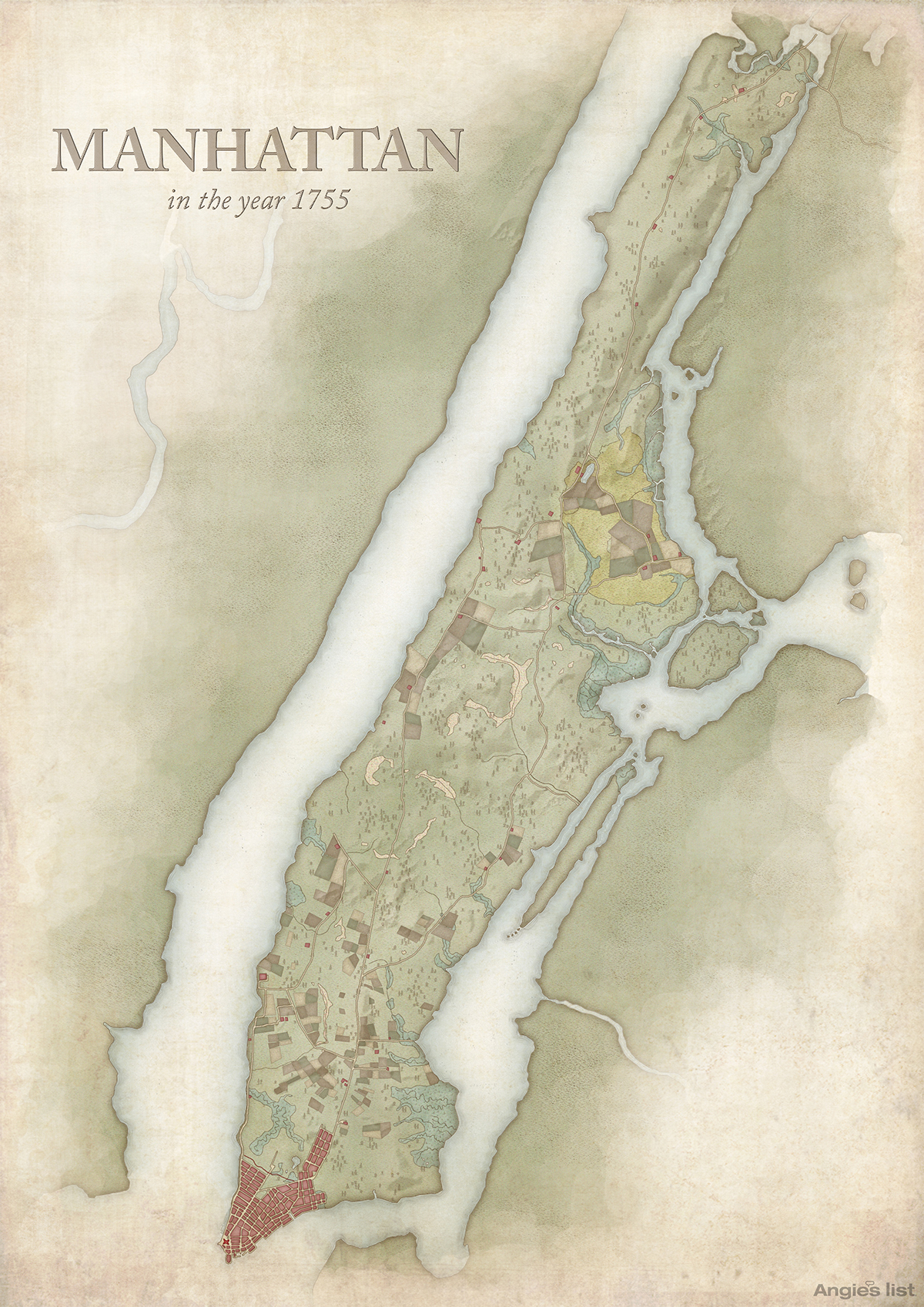
3. Manhattan in the year 1755
“The streets do not run straight as those in Philadelphia and have sometimes considerable bendings; however they are very spacious and well-built.” That’s how Swedish botanist Pehr Kalm described the city In 1749. At this time there was a log palicase running across the city. It was erected in 1745 as part of The French and American Indian Wars.
4. Manhattan in the year 1776
This map shows New York City as it was just prior to the American Revolution. North of Lower Manhattan you can see fields, large estates and gardens that were connected to the city by Bowery Road running up the middle of the island and the Road to Greenwich along the Hudson. Greenwich was then still a seperate village and as of 1766 the street system went as far as north as what is Soho today.

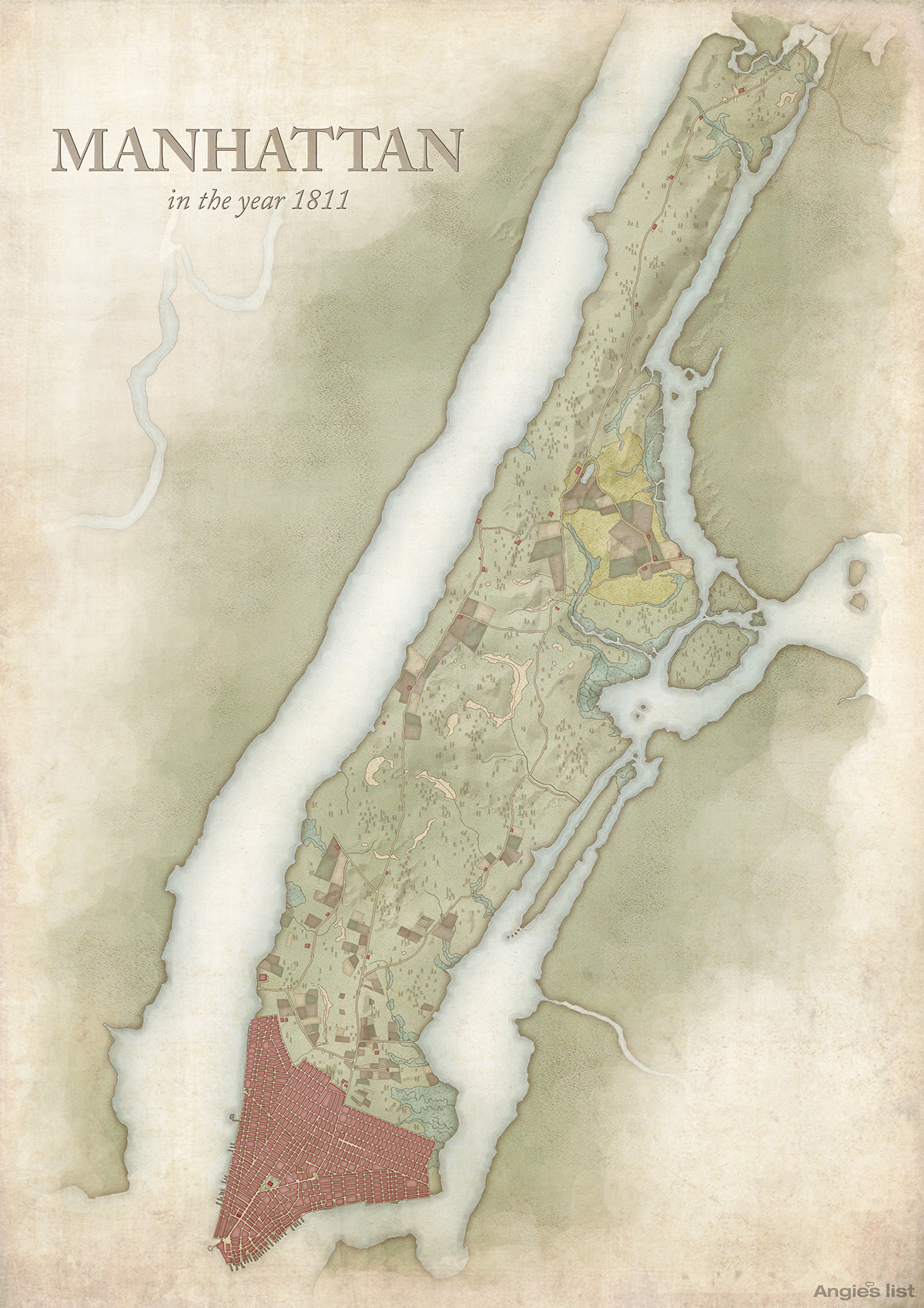
5. Manhattan in the year 1811
The city’s famous street grid system was created in 1811. The Plan paid no mind to existing properties; farms, estate houses and even hospitals were divided or demolished to make room for the new streets. It‘s been estimated that two out of every five structures were “mapped over.” Two years later in 1813 First Avenue opened.
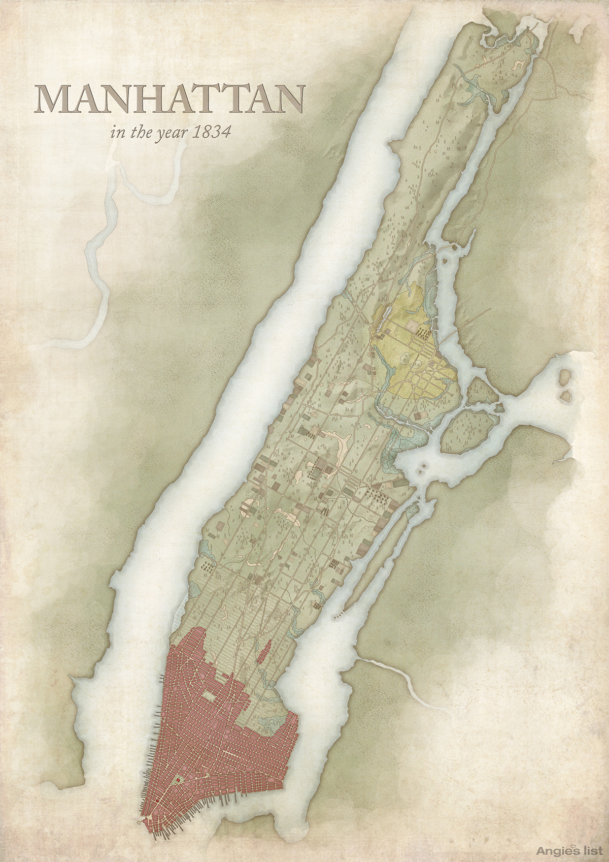
6. Manhattan in the year 1834
This map shows a city in the midst of explosive growth, both in terms of population and land development. Demand for land was growing so rapidly that the city even began selling “water lots” along the shore, where daring entrepreneurs could create their own plots. In the year of 1834, 21st Street in Chelsea opened and the street numbers began reaching the high 30s.
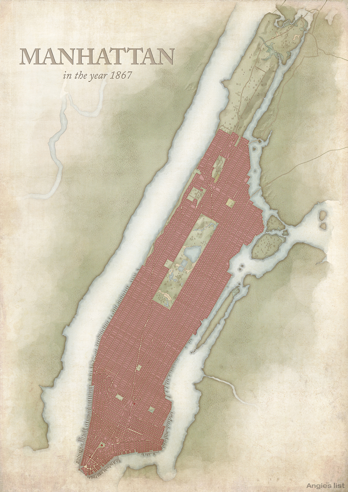
7. Manhattan in the year 1867
By the beginning of the 19th Century, the Manhattan street plan was complete. We can now see the different ward areas and the city as we now know it is really emerging. 57th Street in Midtown opened in 1844 and by 1859 one of the city‘s, if not the world‘s most beloved attractions, Central Park opened for public use. Two years after this map, construction on the Brooklyn Bridge began.
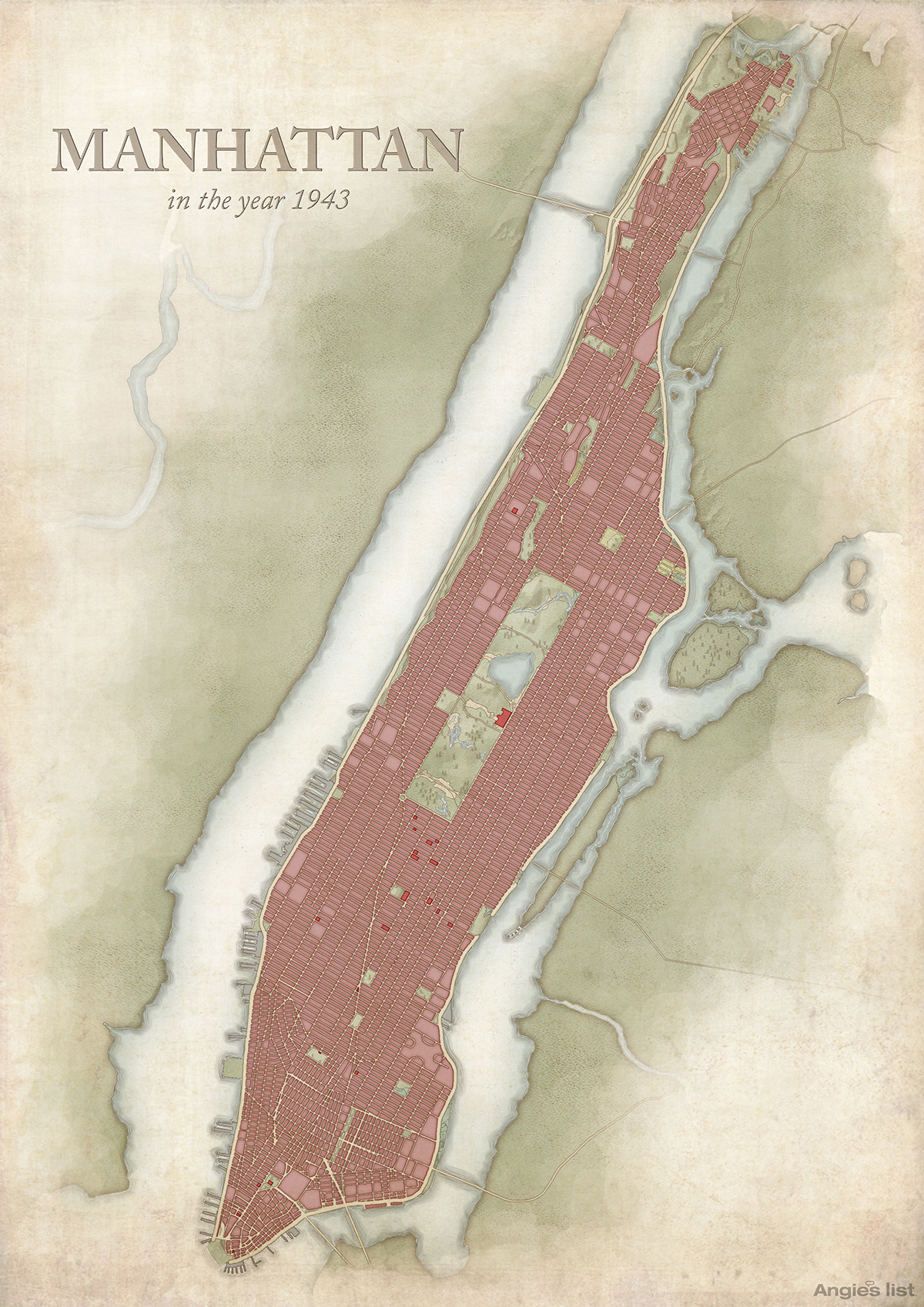
8. Manhattan in the year 1943
On the way to 1943 some of the city‘s most famous buildings were built. In 1891 Carnegie Hall opened, in 1910 construction of the Pennsylvania Station began and in 1923 Yankee Stadium opened. This period of construction also saw some of the city‘s most iconic skyscrapers spring up; the Empire State Building, the Chrysler Building and 30 Rockefeller Plaza were all built by the time of this map.
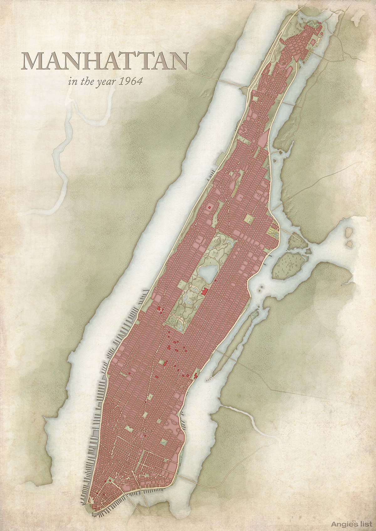
9. Manhattan in the year 1964
By 1964 the city becomes recognizable to the modern viewer. In the 21 years since the previous map, the building continued apace and some of the city‘s most visited cultural institutions opened. In 1959 the Guggenheim Museum opened its doors, the Lincoln Center for the Performing Arts opened in 1962 and Madison Square Garden opened in 1968. In 1970, construction began on the World Trade Center.
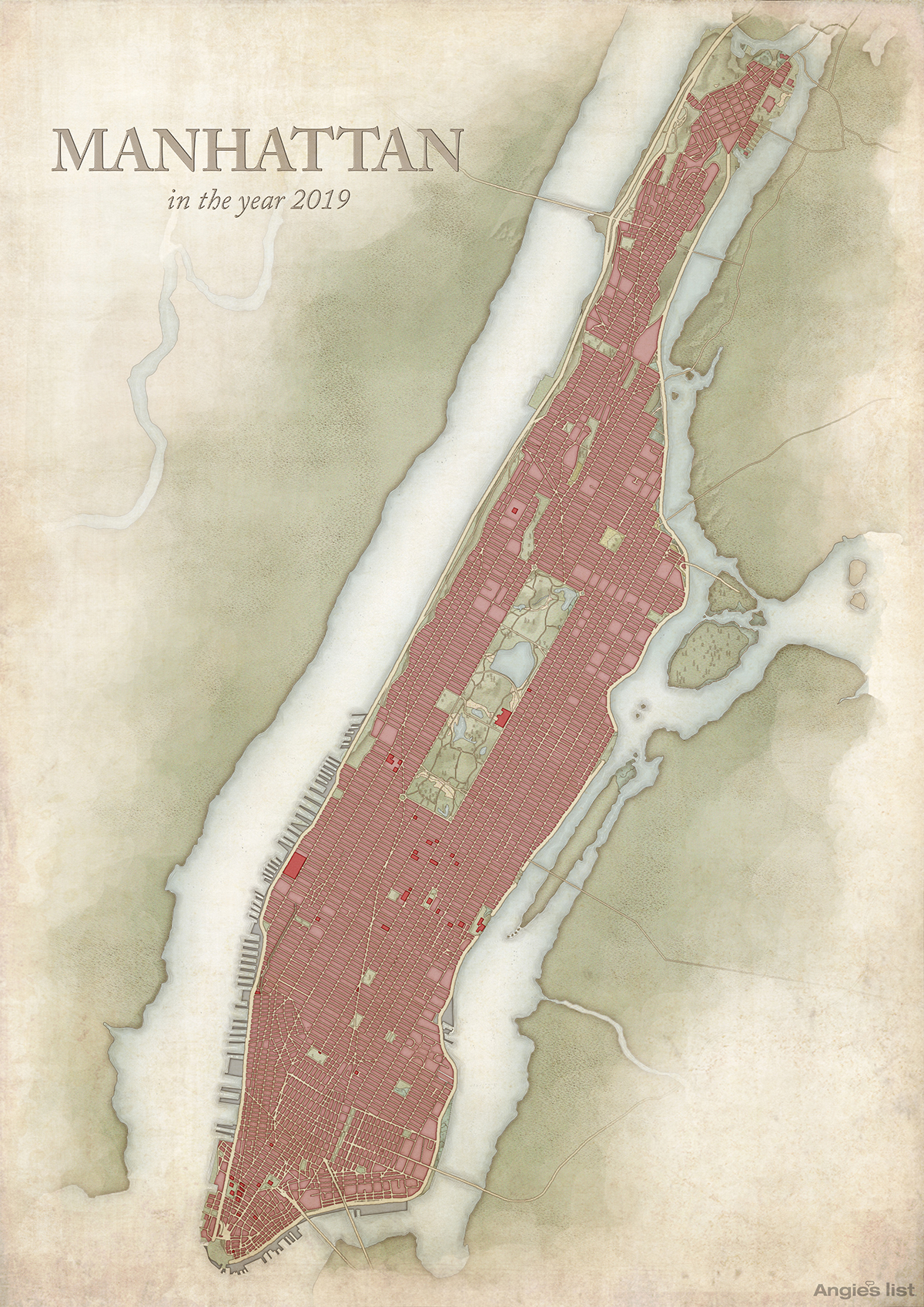
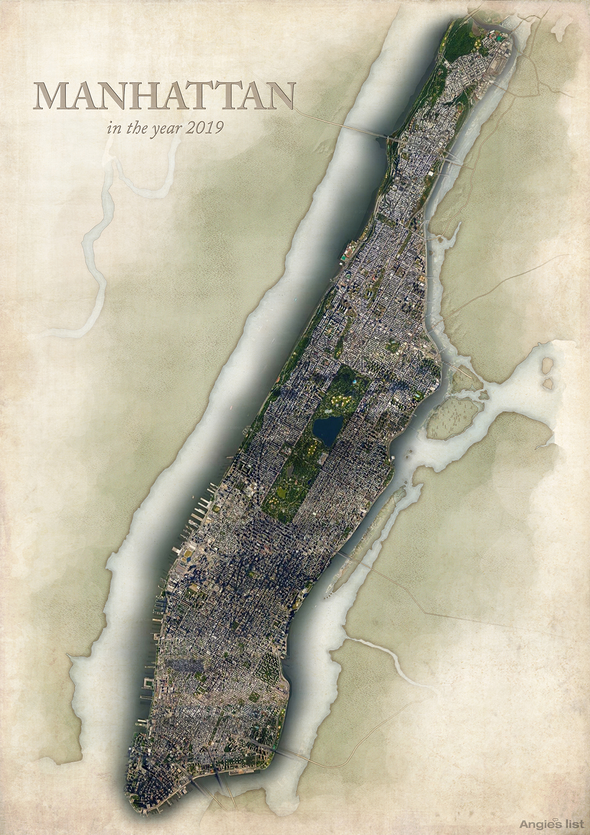
10. Manhattan in the year 2019
Here we are in the modern day. Since the previous map a lot more has changed. At the risk of repeating ourselves, yes you guessed it, more construction has taken place. In 1979, the Javits Convention Center was started, the High Line opened in 2009 and the city has become even more crowded with both buildings and people.
These maps show how much has changed on this island since the 1600s. From wild lands to bustling metropolis.
What do you think it will look like in another 100 years?
Methodology
To create these maps our researchers started by searching through various archives, including the New York Public Library and the Library of Congress, for maps that showed all or significant portions of Manhattan. They then selected maps to represent each century in order to show the changes throughout time.
Once a series of maps were chosen, they went on to research each one individually to understand the most significant locations and changes that occurred over the years in between.
There are limited maps from Manhattan’s early history around, so our researchers chose the most detailed and complete from the maps that were available. They chose maps that showed as much data as possible in relation to the whole island, opposed to just one section of the island.
They also took into account historical importance. For example, they included the first map of Manhattan, as well as the earliest map that showed the plan for the street grid system.
Bonus Treat: Compare New York Then and Now
Did you know that you can view and compare aerial photography of all five boroughs of the city of New York from as early as 1924 to contemporary images from the official Internet web site of the city of New York?
This alone can potentially keep my attention for hours.
Summary
I personally would have liked to have seen similar maps created for the remaining four boroughs of the city of New York — but the aforementioned link in the bonus treat section of this article will more than suffice in the meantime.
Years ago, I purchased a book which compares photographs in New York over the decades. I intend to take a picture of that book and eventually insert it into this article.
As I was born and raised in the city of New York, its history always fascinated me — and still does to this day.
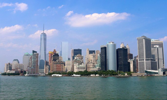
Photograph ©2015 by Brian Cohen.
